
Case study / 05
GeospatialCrop Analysis
A geospatial intelligence platform that transforms freely available satellite imagery into crop health, crop-type, and agricultural decision insights for Québec and beyond.
LIVE PLATFORM / AWS DEPLOYMENT
OPERATIONAL ANALYTICS / MULTI-USE-CASE SYSTEM
Case study / 05
Project context
Agriculture & Geospatial Intelligence
Plumfind contribution
Geospatial Analytics
AI & Intelligent Systems
Technology
Sentinel-2, Landsat, Prithvi AI, Geospatial Processing, AWS
Timeline
Use-case research, pipeline development, regional-scale deployment
BUSINESS CHALLENGE
Vast agricultural territory. Limited real-time visibility.
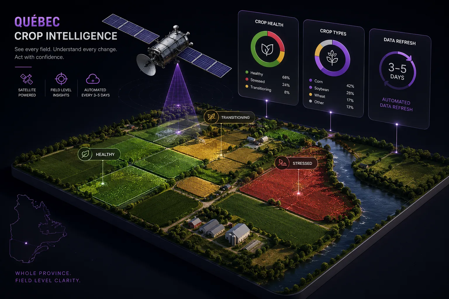
Farmers, insurers, lenders, and government stakeholders lack timely, scalable visibility into crop conditions, making critical decisions dependent on field surveys, historical data, and delayed reporting.
LACK OF TIMELY INSIGHTS / DECISION GAP
DISCOVERY & RESEARCH
01 / Business context
We began with the agricultural decisions that require timely visibility into crop health, crop types, and changing field conditions.
02 / Use case
Farmers, insurers, lenders, and government stakeholders informed the intelligence and reporting requirements.
03 / Decision layer
The solution prioritizes crop stress, health, maturity, distribution, area, and trends rather than exposing raw satellite imagery.
04 / Production plan
Tile-based processing and batch execution were designed to extend the workflow from individual plots to Québec-wide monitoring.
PRODUCTION REQUIREMENTS / AGRICULTURAL INTELLIGENCE
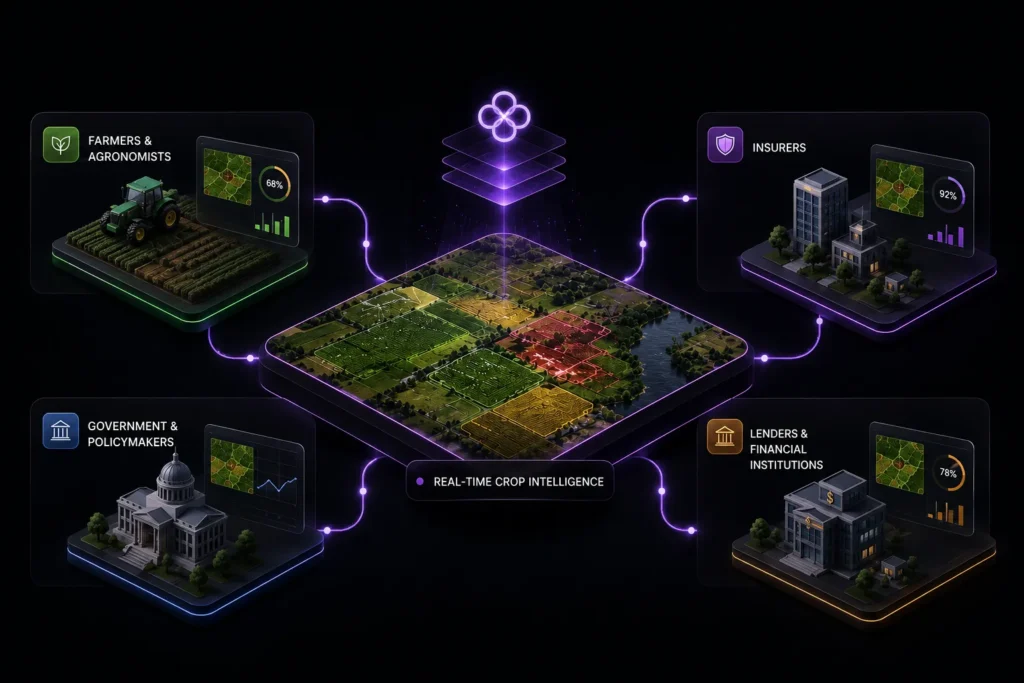
Different decisions. One shared intelligence layer.
We mapped the information needs of farmers, insurers, lenders, and policymakers to define a common geospatial intelligence framework that could support field-level decisions and province-wide analysis.
SOLUTION
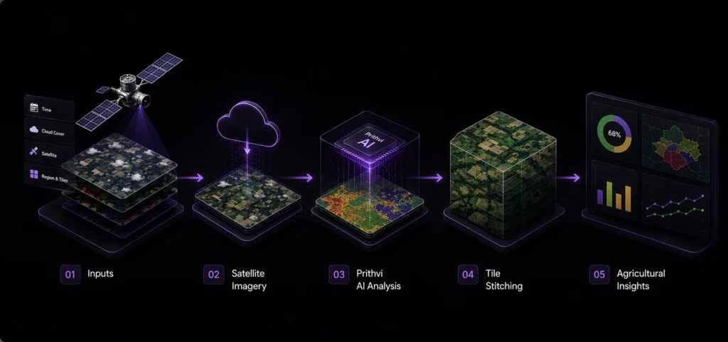
From raw satellite imagery to actionable agricultural intelligence.
01
Automated satellite image acquisition
Sentinel-2 and Landsat imagery is automatically sourced and filtered by time period, cloud cover, satellite, and geographic tile.
02
AI crop detection
A geospatial foundation model (Prithvi) processes satellite scenes to generate georeferenced crop probability and crop-type maps.
03
Tile-based processing
Individual scenes are aligned, reprojected, and stitched into complete crop maps for each geographic tile.
04
Custom agricultural analytics
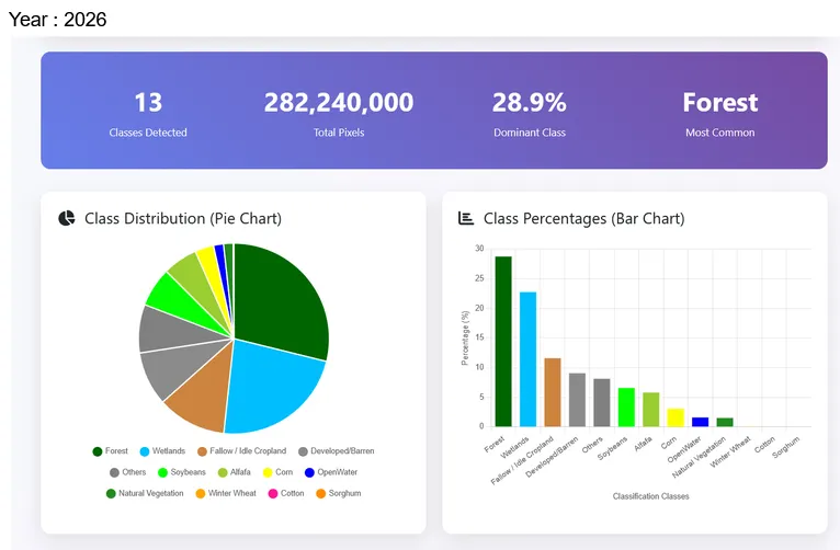
Crop areas, types, trends, and zonal statistics are transformed into reports, dashboards, and exportable datasets.
Architecture / system flow
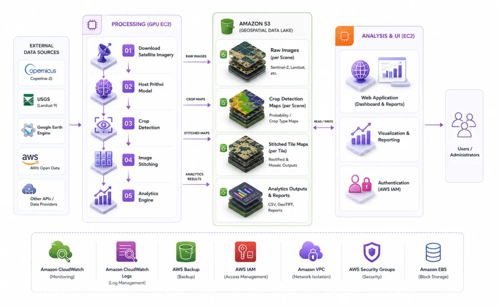
Insights at scale thanks to AI and the cloud.
Each stage converts raw geographic data into a more structured layer of agricultural intelligence, while maintaining geospatial accuracy throughout the pipeline.
Implementation
From satellite data to a dependable production pipeline.
01
Data acquisition & processing
Automated downloads retrieve relevant Sentinel-2 and Landsat imagery based on defined geographic, temporal, and cloud-cover parameters. Images are aligned and georeferenced to enable consistent tile-level outputs.
02
Analytics & reporting
Custom analysis converts crop maps into area calculations, crop distributions, zonal statistics, trends, reports, and exports.
03
Scale & automation
Independent Tile ID processing enables repeatable execution across multiple geographic areas and batch-scale Québec coverage.
BUSINESS IMPACT
Agricultural intelligence people can act on.
- Enable near-real-time crop health monitoring without new field hardware
- Automate crop-type and field-level geospatial analysis
- Reduce reliance on manual surveys and delayed assessments
- Support earlier identification of crop stress and changing conditions
- Enable insurers to assess agricultural risk and damage more efficiently
- Create a scalable foundation for regional and province-wide monitoring
- Turn freely available satellite data into operational agricultural intelligence
LESSON LEARNED
The value is not in producing more imagery or more model outputs. It is in transforming geospatial data into timely insights that farmers, insurers, lenders, and policymakers can act on.
TECHNOLOGIES USED
Satellite & AI intelligence
AI
Sentinel-2 and Landsat imagery for repeatable, large-scale agricultural observation. Prithvi for crop detection, and crop-type analysis.
Operations layer
ANALYTICS
Crop area, distribution, trends, and statistical analysis for decision support.
Cloud delivery
CLOUD
Automated processing designed to scale from individual plots to Québec-wide coverage.
Related projects
Continue through the work

START A CONVERSATION
Start with the business result.
Bring the question you are trying to answer. We will help you decide what deserves to be built.